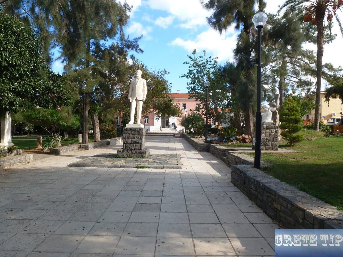
The wild and untapped Agios Ioannis peninsula. The triangular peninsula north of Neapoli and Aghios Nikolaos, east of Milatos and northwest from Elounda is surprisingly wild and not very crowded.
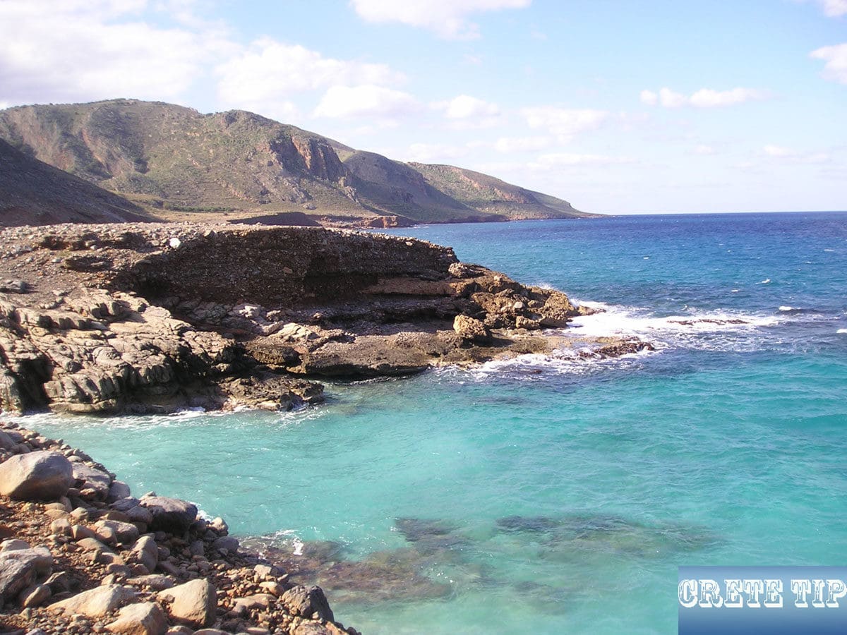
Aghios Ioannis Peninsula
The triangular peninsula of Aghios Ioannis – north of Aghios Nikolaos and inland from Elounda – is surprisingly wild and not very crowded. Narrow streets are leading along secluded agricultural hamlets and small villages.
The section of the main national road from Heraklion, which runs from Malia via Neapoli to Aghios Nikolaos, marks about the southern boundary of the peninsula of Aghios Ioannis.
If one follows the national main road, one first reach the gorge of Sellinari, where the travelers traditionally stop and pray to Saint George for a safe passage. This impressive road, which has been built across many obstacles, leads past the administrative capital of Neapoli and then reaches Aghios Nikolaos, where spectacularly the Gulf of Mirabello in front will be visible.
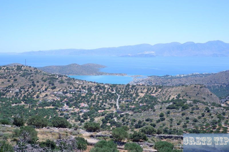
From Neapoli directly to Elounda
If one is not in a hurry, one can also use the small streets that lead over the Aghions Ioannis peninsula. They offer a great alternative to the usual routes to Elounda or to the Lasithi Plateau and are even shorter.
The journey along this picturesque route takes almost as long as if you were travelling on the motorway from Neapoli via Agios Nikolaos and then on to Elounda.

At Neapoli leave the highway and follow the signs to the ‘Amazonas Park’, but then turn down right to the archaeological site of Driros (but do not turn right at the next, shortly following diversion, instead follow to the left) towards Kastelli.
Alternatively one could go directly through Neapoli to the next small village Nikithianos, where one turn left and drives through an underpass of the highway across serpentine to Kastelli. From there continue to Elounda, which is signed.
Although there is not much to see next to the magnificent landscape – except for wonderful views of the Gulf of Mirabello and welcoming tavernas and coffees in the larger villages.

Coming from the west of Malia one start at Milatos with a long and steep ascent to peninsular of Aghios Ioannis.
From Elounda the steep, narrow road winds over Pano Elounda and Pines (previous picture) towards Fourni and Kastelli and meets the highway at Neapoli.
Plaka
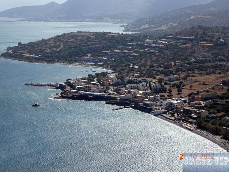
Plaka, about 3 miles (5 km) north of Elounda, lies directly opposite the Fortress of Spinalonga and was once the main supply point on the mainland for the leprosy colony.
Boats still carry the short trip today, but they are now transporting tourists.
The previously more or less dilapidated place has become quite chique since the establishment of the not yet to be overlooked luxury hotel. Many new houses and villas have been built, mostly inhabited by foreign owners.
Plaka is a charming traditional fishing village located in eastern Crete, Greece. There are actually two notable villages named Plaka on the island:
Eastern Plaka (Lasithi):
The more well-known Plaka is situated in the Lasithi region, approximately 16 km north of Aghios Nikolaos. This picturesque village sits along Elounda Bay and is famous for its stunning views of Spinalonga Island directly across the water.
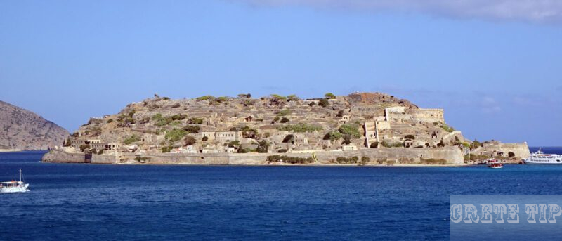
The village features traditional whitewashed houses and offers visitors a [peaceful and authentic Greek experience. It’s known for its seafront tavernas serving fresh fish and local Cretan cuisine.
The beach at Plaka is typical of Crete’s beaches, primarily pebbled, with a narrow wooden boardwalk to help visitors navigate the shoreline.
Plaka is still an attractive, quiet place with a few excellent and well-known tavernas in front of the crystal clear sea.
The beach, however, consists of large, little comfortable pebbles and also a strong east wind can blow through the mouth of the bay between the mainland and the Spinalonga peninsula.
With the drone near Plaka to the fortress of Spinalonga:
Western Plaka (Chania):
The other Plaka village is located in western Crete, [25 km east of Chania in the Vamos municipality](https://www.crete-escapes.com/about-plaka-kokkino-chorio). This Plaka is set on the slopes of Mount Drapanokefala and is near attractions like [the ancient city of Aptera, Kournas Lake, and Samaria Gorge National Park](https://cretelocals.com/towns/plaka-village/).
Both villages offer visitors a glimpse into traditional Cretan life, away from the more commercialized tourist centers of the island.
Wind farm near Vrouhas
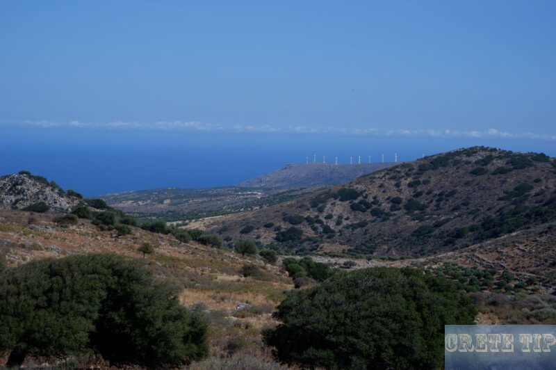
Beyond Plaka begins the other, wild and untapped world of the Aghios Ioannis peninsula. The road winds along the coast to Vrouhas.
Here and in the surroundings there are still many of the old, traditional stone windmills, which are mostly decayed.
Its successors are located in the large, new wind farm in the north-east of the peninsula, from where one have a wonderful view over the sea and the Gulf of Mirabello.

To the wind park one drives shortly before Vrouhas on a mostly better dirt road to the right (the wind park is signposted) and one can drive until the north-eastern tip of the Aghios Ioannis peninsula to a small, white chapel near the cliffs above the sea.

There are also some kind of dirt road from Plaka (turn right behind the pebbles beach), which winds up along the coast to the wind farm. This route is also suitable for hikes or tours with mountain bike or quad bikes.

From Vrouhas to the West

On the route from Vrouhas to Skinais, a narrow road leads steeply down the coast, where some isolated beaches with pebbles, small pensions and seasonal tavernas are located on a rugged, rocky coastal section.

About a 3/4 mile to the west as the crow flies, a steep, paved dirt road leads to the chapel of Moni Agios Andrea, just above the sea, where there is also another stretch of beach.

Just a few hundred yards as the crow flies from here is the Fino Animal Rescue shelter (close to the small village of Finokalia), which is one of the largest in the Aghios Nikolaos area and is run by two German expatriates.
In the loneliness on the secluded Aghios Ioannis peninsula, the two are happy about every visit, donations of food or money and voluntary work at the shelter. Probably you could found your favorite dog from Crete for adoption there!
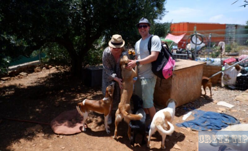
If you love dogs and especially puppies, you should take the opportunity to visit the shelter.
More information and exact directions to Fino Animal Rescue via these two links.
Video of the Aghios Ioannis peninsula and the animal shelter by drone:
Further inland and just behind Skinias, a well-paved road leads to the lonely monastery of Moni Aretiou, which is surrounded by cypresses and cedars and looks like a fortress from the 16th century.
Recently restored, it often appears as completely deserted, but some monks have stayed behind and the gate and church Agia Triadha are usually open.

From there, an asphalted road, which winds at first over barren mountain peaks, leads to next but one village of Dories, where the church of Agios Konstantinos houses an icon of the Panayia (Virgin) from the 14th century, the oldest known on Crete.

The church is located near the village center on a small path from the main road (marked by a small monument in the form of a church). The creme-brown-painted house next door belongs to the Papas, which are available to open the church to visitors.
Amazonas Park
In the direction to Neapoli, one pass the Amazon Park – an animal park as well as the old Doric ruins mountain city of Driros.
The owner of the Amazon Park is reported by volunteers who have helped there to be a friendly person who is fully dedicated to the park. The Amazon Park is very clean and the enclosures are of a very high standard. All the animals and birds there look good and healthy and are not stressed. With birds in particular, if they are not kept well, you quickly see obvious signs such as baldness and loss of feathers in other circumstances.
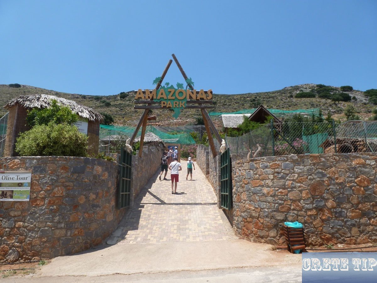
Amazonas Park is a unique wildlife sanctuary and zoo located near Neapoli in northeastern Crete, Greece. Amazonas Park is a private zoo that first opened its doors in 2011. It’s situated between Malia and Agios Nikolaos in the Lasithi Prefecture
Focus and Animals:
– The zoo primarily focuses on animals from South America, especially parrots and monkeys.
– It functions as a rescue center focused on the conservation of endangered wildlife.
– The park is not very large but houses a variety of species
Visitor Information:
– Admission costs €14 per person, with an additional €4 for fruit to feed the animals.
– The park operates more as a rescue and breeding center for endangered species (abandoned or surrendered) than a traditional zoo.
– The park has annual over 10,000 visitors.
The park provides an opportunity to see exotic wildlife while supporting conservation efforts on the island of Crete.
Some tips for the Aghios Ioannis peninsula
Road maps of Crete, which in the best case are not always reliable, do not appear to be particularly helpful on the peninsula. The most obvious, however, is that there is no road which runs completely along the coast from the west to the east, or at least some sort of dirt road, but which is nevertheless recorded on some maps.
It is best to follow the signs and paved roads and one will finally reach the destination.
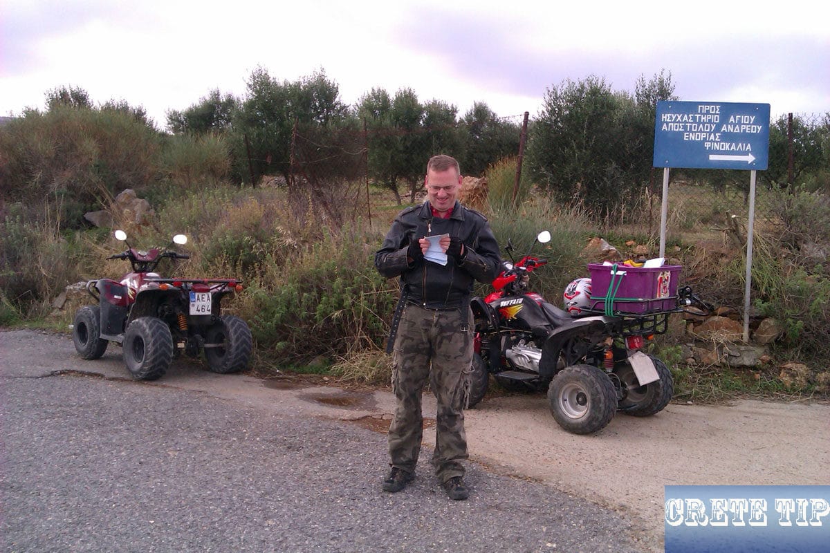
It is also advisable not to exaggerate with remote explorations, since the police are rarely seen in this area, and local gamekeepers have already reported that parked vehicles of hunters from the city were perforated with shotguns after their return from the hunt trip. Additional, the one or other illegal cannabis field is supposed to be hidden here.
Video from the Aghios Ioannis Peninsula
Duration: 1:56 min with views of Spinalonga and Elounda Bay, wind farm and coast and wilderness.

Directions to the beach on the north coast
Click here: Directions Aghios Ioannis Peninsula.


