Tropical Vai beach on the east coast of Crete: The famous palm beach of Vai Finikodasos, the beach of Itanos, Palekastro and surroundings and the Moni Toplou monastery.
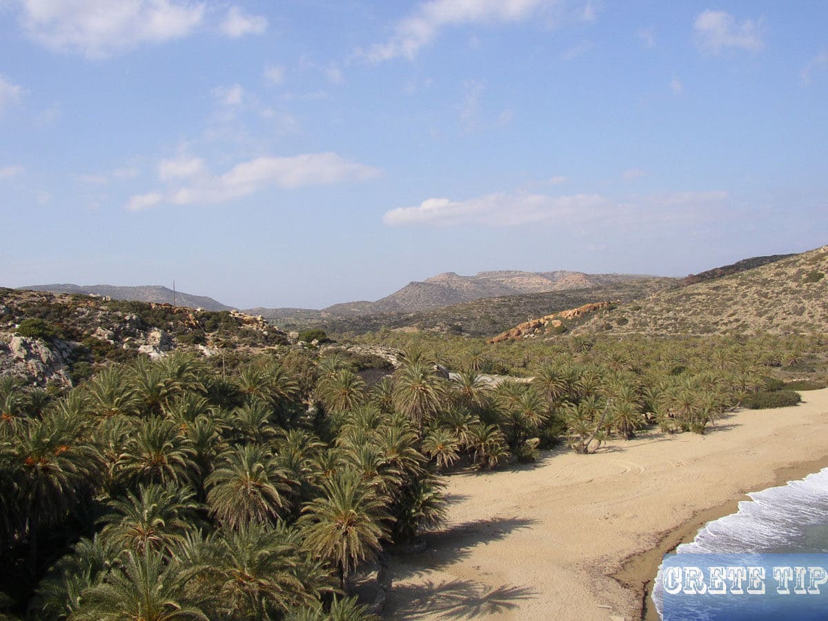
The beach at Vai – the Vai Finikodaos – famous for its palm trees, contrasts with the surrounding area and rest of Toplou.
The beach at Vai
The sudden appearance of Europe’s only wild-palm forest is indeed an outstanding sight. The palm trees are the local species Phoenix theophrasti (Cretan date palm) and have been native to Crete for thousands of years. Their fruits are inedible, as is the case with all the palm trees in the northernmost region of the Mediterranean.
Probably there were more of them at the time of the Minoans, as they are depicted on many ceramics.
Nevertheless, the legends were concerned about the origin of this unusual place. Supposedly, Phoenician traders or the Saracens in the year 824 have eaten dates here and from the remaining cores the first palm trees should be grown.
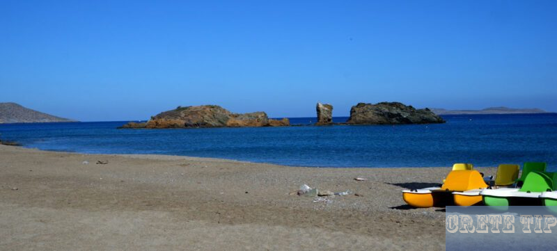
The islands in front of this dream beach were already used as hiding places by pirates and the legends reported that the notorious Chaireddin Barbarossa buried a treasure here after plundering almost all the islands in the Aegean in 1537 and 1538.
Also, for ages, farmers have been using the upper valley of the stream for the planting of well-developed vines.
And when the ‘flower children’ were expelled from the caves of Matala, they settled under the palm trees of Vai until the location was placed under the protection of nature.
The picture with the fine, white sand beach together with the palm trees makes the visitor the impression to be on a Caribbean island, especially in the spring and late summer. In fact, a film about ‘Bounty’ advertising was shot here in a tropical paradise.
The palm trees grow along a stream that runs through the valley along with the access road.
Today, the beach is overcrowded during the main season. Numerous excursion buses with tourists from Sitia and the whole island meet daily in the large parking lot. Nevertheless, the parking lot is quickly overcrowded, so also vehicles are parking left and right of the access road.
In the area of the car park the place is touristy strongly marketed by kiosks, souvenir shops and tavernas.
On the beach itself one can often walk only along the promenade, because on the sand body lies next to body. There are not really cheap sun loungers to hire and various water sports activities are offered, such as water skiing, ringos and high-speed rides.
Also, there is a café and an expensive tavern. For the use of the showers or toilets must also be paid extra.

Behind the tavern one can climb the steps to a rock, from where one has a magnificent overview. Further to the south you can also reach a less shady bay – or with more effort climb to the next bay over the rocks at the northern end of the beach at Vai.

At the end of the day you can also enjoy Vai during the season as it should be in this environment. Or you can visit at the beginning or at the end of the season.
The pictures here from the beach at Vai were taken all at the beginning of the season (first days in May) or from January, where there are often two wonderful weeks on Crete (the so-called ‘mid-winter summer’).
Video about the beach at Vai
Tip: Itanos beach
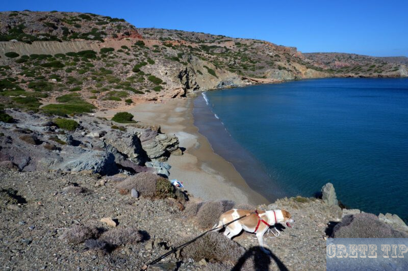
On the other hand, Itanos – about a mile north of Vai – has three smaller beaches, which are not so crowded. Although the sand and the ambiance is not as impressive as at the beach at Vai, however you can enjoy there a beach holiday much more during the season.

Not far from there, scattered over the hill above the beach, is a freely accessible historical settlement that has been inhabited since Minoan times. Ancient Itanos, however, reached its peak of prosperity later, when it competed with Hierapytna – today’s Ierapetra – for control of eastern Crete during the classical Greek and Roman eras.
A twenty-year conflict between the two cities ended in the arbitration of Magnesia in 132 BC, part of the records of which, carved in stone, still survive in the monastery of Toplou.
The settlement remained prosperous until its destruction – probably by Saracen pirates – in the second Byzantine era in the Middle Ages. Any number of chaotic ruins, strewn with fragments, have survived the time below the twin acropolis, but there is little whose forms can still be assigned. There are also the remains of two early basilicas and the beautifully cut lower layers of the city wall from the Hellenistic period on the western hill.

More photos from Vai and Itanos

Cape Sidheros

Cape Sideros (also known as Kavo Sidero) is located at the northeastern corner of Crete, 32km east of Sitia and 99km east of Aghios Nikolaos, near the Naval Station of Crete. It is the eastern end of the island of Crete.
In ancient times, Cape Sideros was known as Samonium, Samonion, Sammonium or Salmonion. The cape is part of the Coastal Hill Range of East Crete, which trends northeast from Xerokampos in the southwest towards Cape Sidero.
The area around Cape Sideros is also known as Agios Isidoros or Agios Sideros. The cape offers stunning views and is home to some ancient ruins.
The waters off Cape Sidero are the deepest section of the Aegean Sea, reaching depths of more than 10,000 feet (3,294 m).
Monastery of Moni Toplou
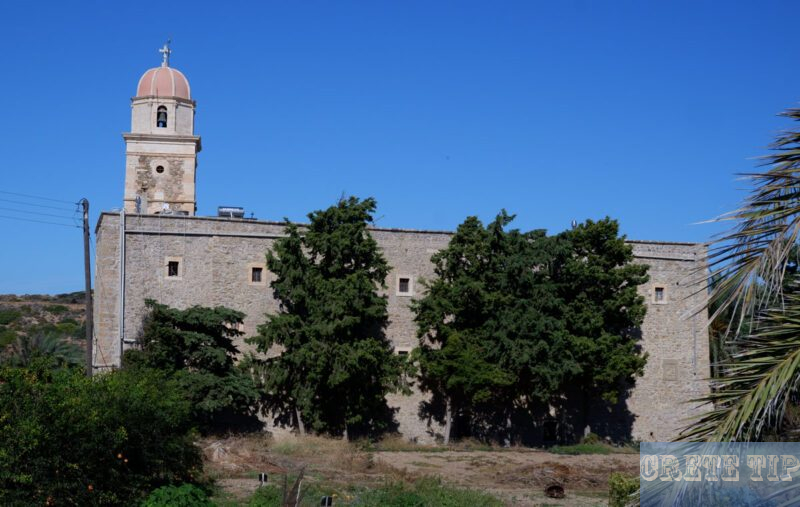
Already barely 15 kilometres east of Sitia (and thus even before Fai Finikodasos, the village of Palekastro and, of course, Kato Zakros), a turnoff leads to the Moni Toplou monastery, 3.5 kilometres away.
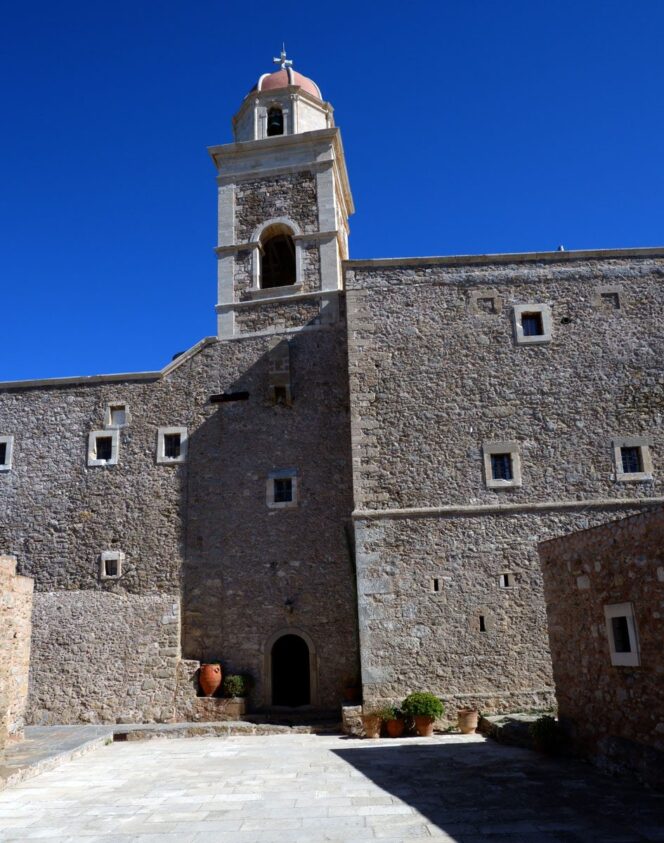
Defiantly, the monastery, whose real name is Moni Panagia Akrotirani (‘Monastery of Our Lady of the Cape’), stands in the middle of a landscape that is deserted except for a series of wind turbines along the ridge behind it that provide electricity.
The monastery looks much more like a fortress and must have been built in the mid-15th century. The monastery’s epithet ‘Toplou’ is no accident, for in Turkish it means ‘with a cannon’. This was a reference by the Turks to a huge weapon with which the monks defended themselves and preserved the tradition of Cretan monasteries to defend themselves against invaders. There were always one or more loaded cannons on the 10-metre-high walls.
Legend has it that you can see all the way to Rhodes from the monastery’s bell tower, but in any case you could see any approaching dangers early enough from the high monastery.
Highlights of the monastery’s history include being sacked by pirates and destroyed in 1498, then sacked again by the Knights of Malta in 1530, an earthquake in 1612 again causing severe damage, falling under Turkish suzerainty in 1646, then being conquered by the Turks during the Greek Revolution of 1821 when twelve monks were hung from the gate as a deterrent, and its function as a refuge for partisans during the Second World War. Even a simple radio station was built in the monastery during this, which is now on display in the museum next to the monastery’s church.
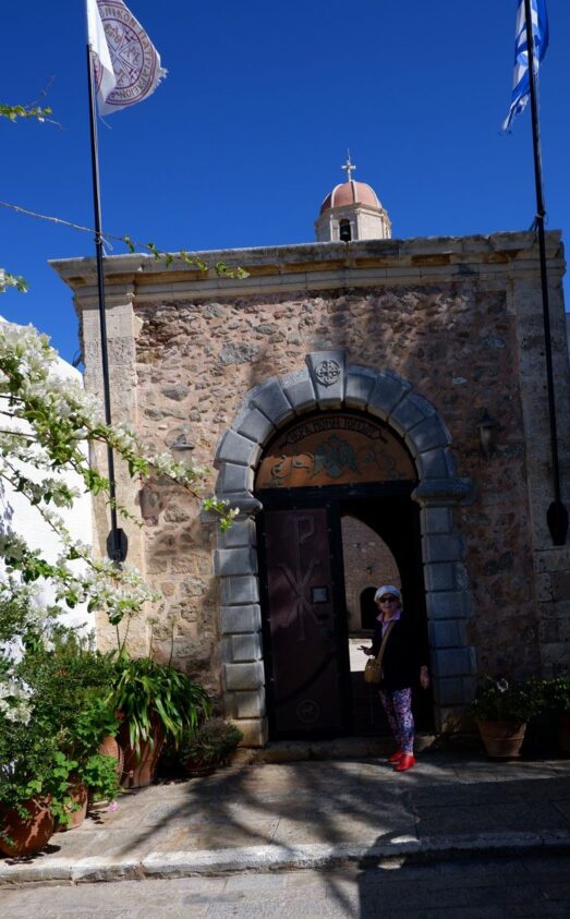
The monastery is also immensely rich, claiming most of the north-eastern corner of the island as its own. This is undoubtedly why the order could afford the extensive restoration work that makes the place so immaculate.
Stairs lead up from the cloister-like courtyard to the arcaded corridors in front of which the cells are located. The monks, dressed in blue, keep out of the way of visitors as much as possible, and in quiet hours you can also visit their cells and the refectory with its spectacular modern frescoes.
Inside the church is one of the masterpieces of Cretan art, the eighteenth-century icon ‘Lord, you are great’ by Joannis Kornaros. This wonderfully intricate work comprises 61 small scenes full of detail, each illustrating and inscribed with a part from the Orthodox prayer which begins with this phrase.
Next to the church portal is the ancient inscription already mentioned, which includes parts of the treaty between the Eastern Cretan cities of Hierapytna and Itanos.
At that time, the Romans ruled Crete, yet these deadly rivals were constantly clashing. When Rome had had enough and found itself unable to placate the two squabblers, it called in the Magnesians as honest mediators. The inscription records part of their verdict, which was in favour of Itanos, and was placed in the monastery wall at the suggestion of the English traveller and antiquary Robert Pashley, who found the inscription tablet in 1834, which had previously been used as a tombstone.
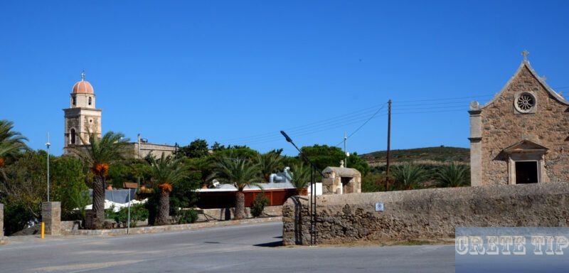
Next to Moni Arkadi near Rethymno, Moni Toplou is the most visited monastery in Crete.
Palekastro and surroundings

Palekastro (also spelled Palaikastro) is a village located in the easternmost part of the island of Crete, Greece. It is situated about 20 km east of the town of Sitia in the region of Lasithi.
Palekastro is the biggest village in the Sitia area, with about 1300 permanent residents. It is a rural, unsophisticated Cretan village that gives access to the natural, historical, and archaeological wealth of the region.
The village stands on historical soil. During Minoan times, the region was a significant center, and the ancient town of Itanos was located nearby. The name Palekastro comes from the nearby Kastro, which is the ruins of a Venetian castle.
Palekastro is conveniently located for exploring the eastern part of Crete. It is about 144 km east of Heraklion, the capital of Crete. The village has amenities such as tavernas, cafes, shops, and accommodations for visitors.
Some of the notable attractions near Palekastro include the palm forest of Vai, the Minoan site of Roussolakkos, and several beautiful beaches such as Chiona and Kouremenos.
Roussolakkos, the ancient Palekastro
Ancient Palekastro, particularly the archaeological site of Roussolakkos, is a significant Minoan settlement located near the modern village of Palekastro in eastern Crete.
Historical and Archaeological Significance
Minoan Settlement: Roussolakkos is one of the most important Minoan sites on Crete, inhabited from the Late Minoan I period (around 1600 BCE) until the end of the Minoan civilization.
Urban Layout: The site is noted for its well-preserved urban layout, including streets, residential areas, and public buildings. This provides valuable insights into the urban planning and architectural styles of the Minoan civilization.
Excavations and Discoveries
Early Excavations: Initial excavations at Roussolakkos were conducted in the early 20th century by British archaeologists. Continuous excavations have since revealed a wealth of information about the site.
Buildings and Artifacts: Archaeologists have uncovered various buildings, including houses, workshops, and religious structures. Significant artifacts such as pottery, tools, and inscriptions have been found, highlighting the daily life and economic activities of the Minoans.
Sanctuaries and Religious Practices: The site includes evidence of religious practices, with sanctuaries and altars suggesting the importance of religious rituals in Minoan society.

Unique Features
Drainage System: Roussolakkos is remarkable for its advanced drainage system, which includes sophisticated water management techniques. This highlights the Minoans’ engineering skills.
Pottery and Art: The site has yielded an impressive collection of pottery and art, including decorated ceramics and frescoes. These artifacts are crucial for understanding Minoan art and symbolism.
Tablet Inscriptions: Linear A tablets discovered at Roussolakkos provide insights into the administrative and possibly linguistic aspects of the Minoan civilization.
Cultural and Historical Context
Trade and Economy: The location of Roussolakkos near the coast indicates its role in trade and commerce. The artifacts suggest a prosperous community engaged in both local and long-distance trade.
Destruction and Abandonment: Like many Minoan sites, Roussolakkos experienced destruction, possibly due to natural disasters or human activity, leading to its eventual abandonment.
Visiting the Site
Accessibility: Roussolakkos is accessible from the village of Palekastro. The site is well-signposted and can be visited by those interested in Minoan history and archaeology.
Guided Tours: For a more in-depth understanding, guided tours are available, offering detailed explanations of the site’s significance and the discoveries made there.
Nearby Attractions: Visitors to Roussolakkos can also explore other nearby attractions, such as the beaches of Kouremenos and Vai, and the picturesque village of Palekastro itself.
Preservation and Conservation
Ongoing Research: Archaeological research continues at Roussolakkos, with efforts focused on uncovering more details about the Minoan way of life and their advanced urban planning.
Conservation Efforts: Preservation efforts are crucial to protect the site from environmental damage and ensure that it remains an important historical and educational resource.
Roussolakkos offers a unique window into the Minoan civilization, providing valuable insights into their urban planning, daily life, and cultural practices. It’s a must-visit for anyone interested in ancient history and archaeology.
Link to map with directions:
Click here: Directions Vai beach !

